9/16/2022
Everyone knows that America was discovered in 1492, and many people think that's why it has no history.
Sure, it doesn't have as rich a history as Europe, but it does. And a lot of things have happened in Boston. The city was founded in 1630.
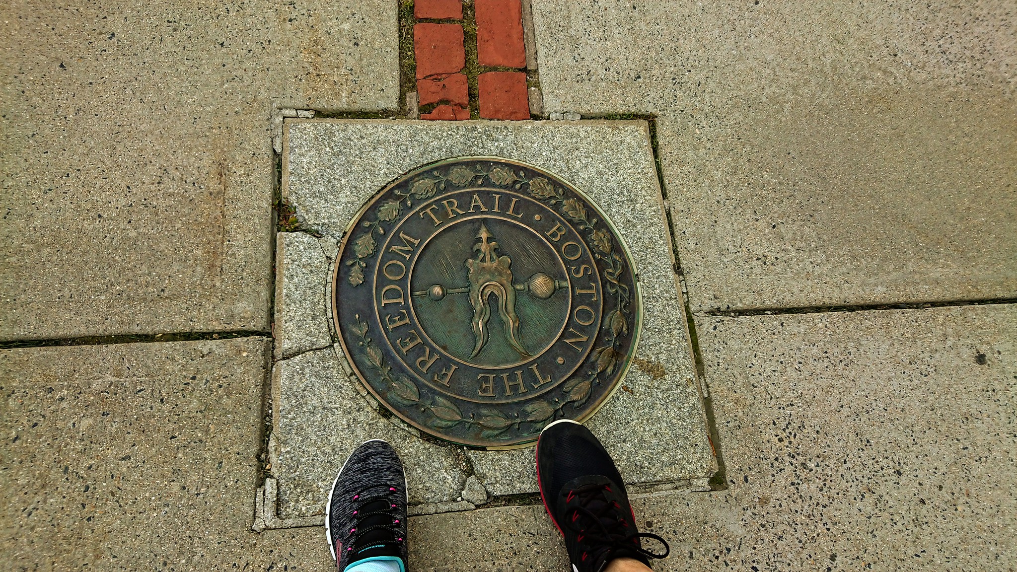
And the Freedom Trail is a 2.5-mile (4 km) path that runs through Boston, visiting 16 historic sites.
The mostly brick-lined area winds from Boston Common downtown through the North End to the Bunker Hill Memorial in Charlestown.
A red line is painted along the way; if you follow it, you can see all the major landmarks.
We had already visited some landmarks in the previous two days. Still, we had agreed to walk the entire route in one day, shortening it by the places we had already visited.

This is what we set out to do on Friday.
This trip is supposed to take 2 hours. Maybe, but not for us! 😀

After breakfast, we went to the city. The bus took a different route again because the original path was closed due to a burst pipe. The water had flooded two stores entirely on the first floor. The whole street was smashed.

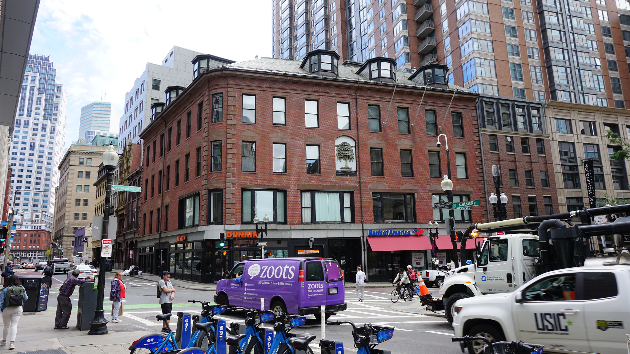
At the point where we got off, Csibi remembered that nearby was the Chinatown neighborhood. This is the cultural center of the local Chinese community. There is a prominent Chinese gate at the entrance, so we wanted to go that far.
The tour was a bit messy and "dirty" because of the broken pipes, but it's definitely charming and worth a detour to check it out.
There is a large Chinese population in the city. A Chinese woman was selling her wares, and others were playing chess or chatting in the park. Aside from the tourists, of course, almost everyone was Chinese.

After visiting Chinatown, we went back to Boston Common because that's where the Freedom Trail starts (from the Visitor Center, to be exact).
We went to the restroom and then started following the red line.
The first stop was the gold-domed State House, and the Robert Gould Shaw and the 54th Regiment Memorial were next to it.
The State House has been the seat of the Massachusetts government since it opened in 1798.

The next landmark is the Park Street Church. Turn around and walk straight to the corner where the church, founded in 1809, stands, the first landmark travelers saw on their way to Boston.
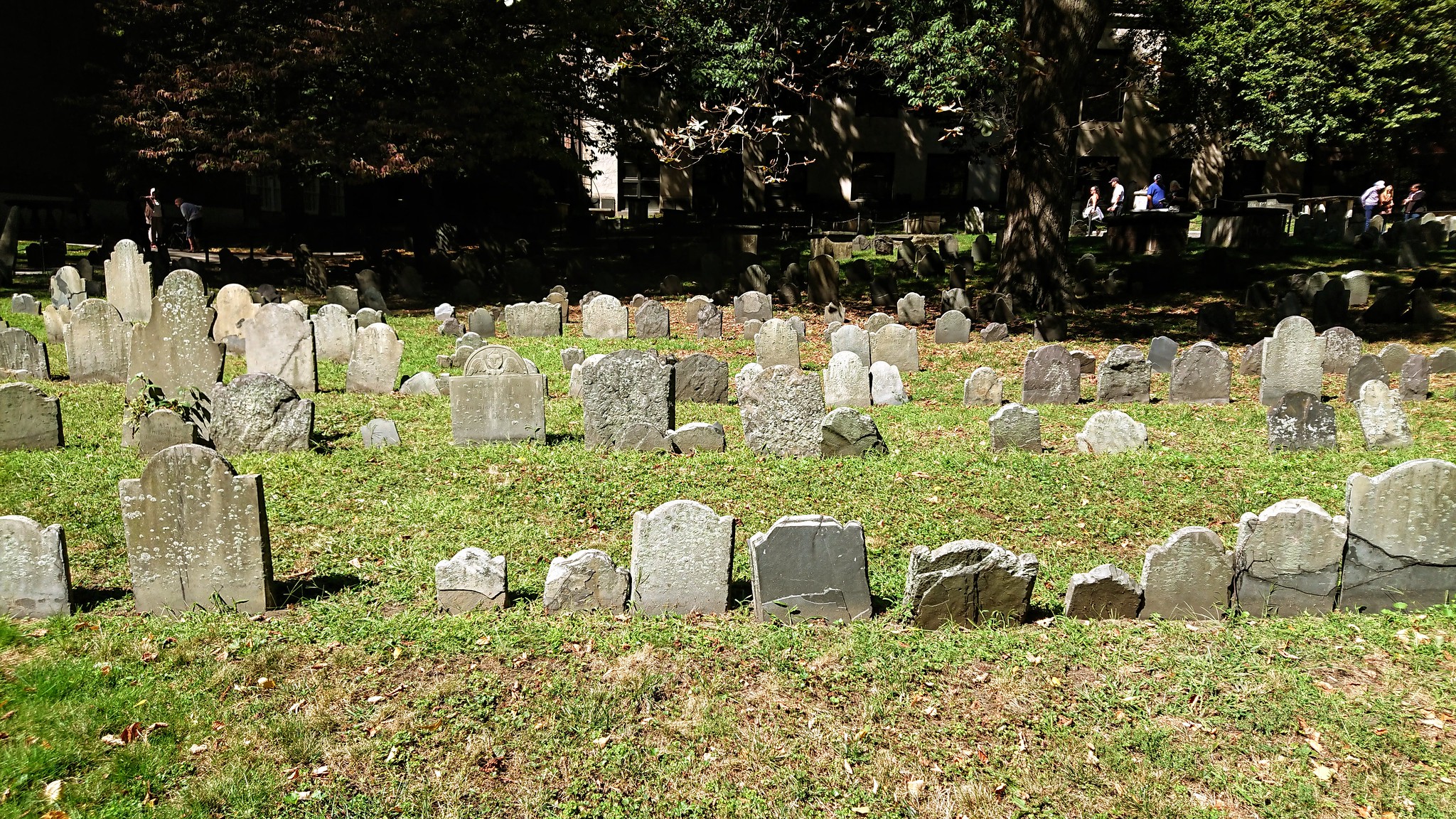
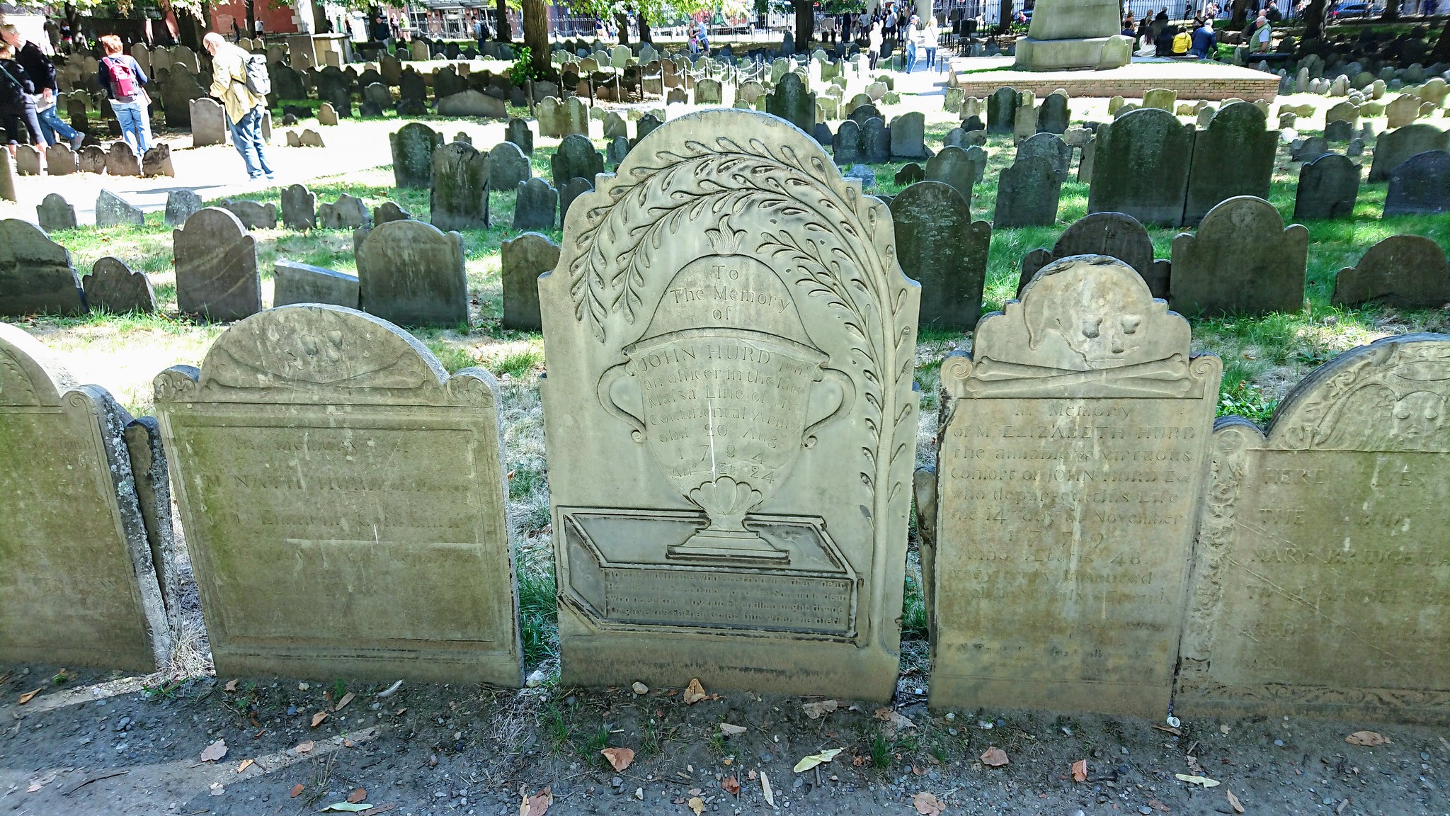
Next to the church is the Granary Burying Ground, a cemetery founded in 1660 where some of America's most prominent citizens are buried.
At the entrance, a man offers a map that one must return at the end. It is possible to leave him some money in the pocket folder, there we also put some money.
We walked around the cemetery and visited the most important graves. For the first time, we felt touched by history, walking along the graves from the late 16th century.
In the center of the cemetery is an obelisk erected by Benjamin Franklin in memory of his parents.
One of the founding fathers of the United States, Franklin, was involved in drafting the Declaration of Independence and, later, the U.S. Constitution. A man of many talents, he was the inventor of the lightning rod and is considered the oldest American chess player.

But John Hancock, another founding father of America and one of the wealthiest men in the 13 colonies before the Revolution, is also buried here. Paul Revere, famous for his midnight ride, is also buried here. I told you about him in a previous post.
In the two front corners of the cemetery are James Otis and Samuel Adams graves. Next to Adams' grave are the victims of the Boston Massacre.
The gravestones are fascinating. One of the most popular motifs is the skull. In fact, it adorns most tombstones. The Puritan churches did not believe in religious icons or images, so Bostonians used the headstones as artistic expressions of their belief in the afterlife.
The next stop is King's Chapel and King's Chapel Burying Ground.
King's Chapel is the first Anglican church in Boston and dates back to 1686. The 1754 building still stands on the church's original site, on the corner of Boston's oldest English cemetery.
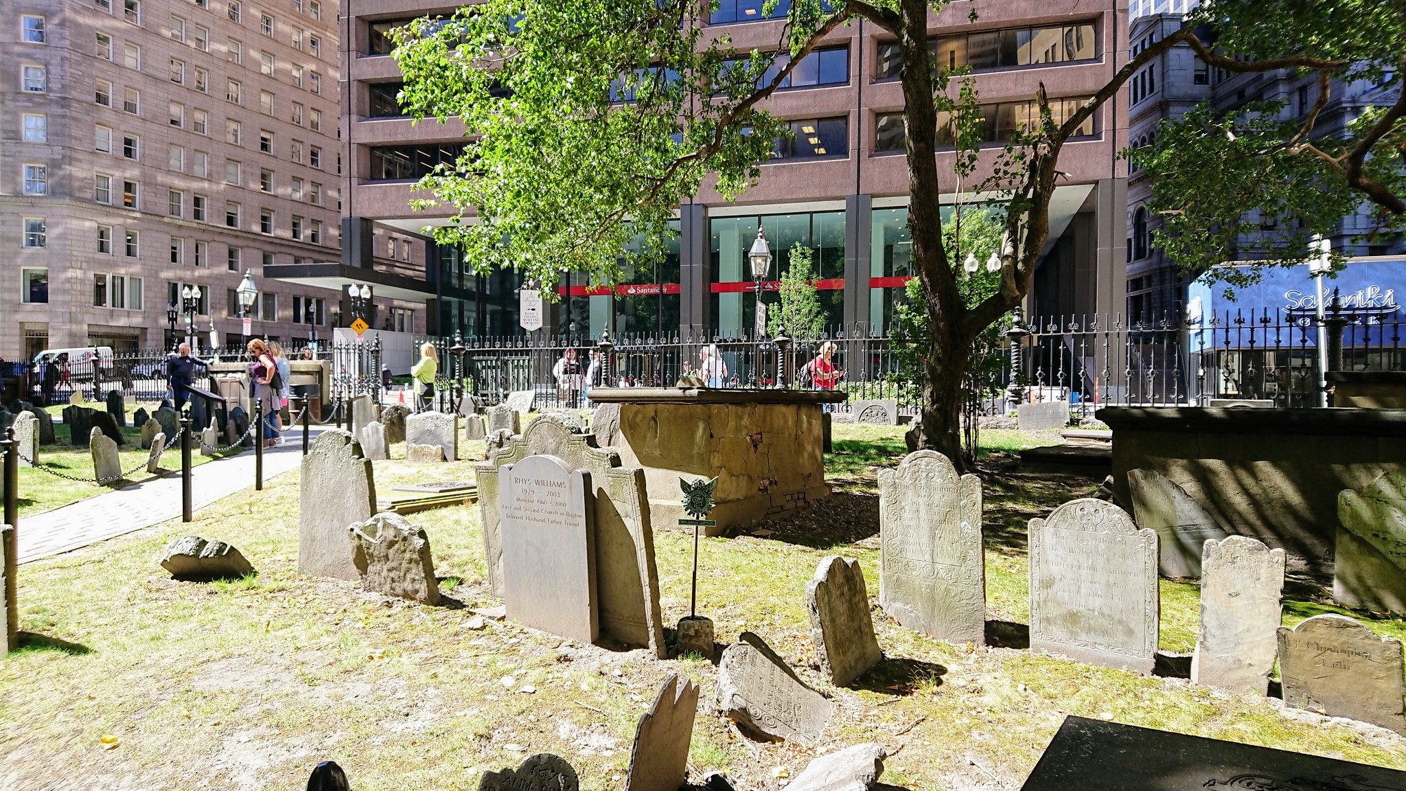
An admission ticket is required to enter the church. We skipped that because we knew we still had a long way to go. But we did visit the cemetery.
From here, you can see a mosaic on the ground. This refers to the founding of the oldest school in America: on April 23, 1635, the Boston Latin School was founded. This school offered free tuition for boys. Girls attended a private school at home. A statue of Benjamin Franklin (a former student) marks the location of the original school. The original school, demolished in 1745, is now located in Boston's Fenway neighborhood and has been open to boys and girls since 1972.

Today there is the Old Town Hall. And in the garden, there is a donkey and a footprint decorated with elephants. This is the symbol of the Democrats and Republicans. When Andrew Jackson founded the Democratic Party and ran for president in 1828, his opponents thought he was a fool. But he used the donkey to his advantage on election posters and made it the symbol of the Democratic Party. The footprint opposite the donkey, with the elephants in it, is a reference to the opposition and became the official symbol of the Republicans.

Next is the Old Corner Bookstore. Built in 1718, it is the oldest commercial building in downtown Boston.
Today it is a fast food restaurant (Chipotle). We did not go in here.
However, we did visit the Old South Meeting House and the Old State House yesterday, for which we have a joint ticket. You can read about it in a previous post.
From there, we went to the plaza in front of Faneuil Hall, where we had also been before but didn't go in.
This time we made it, but before that, there was an incident that delayed our schedule by at least half an hour.
It happened that music was playing, and a couple of guys and a girl were sharing that there was a show starting in a few minutes and everyone should come to watch it.
We were curious to see what would happen, so we went along. They danced, played music, and then got some people from the audience involved. Including Csibi… 😄
Ultimately, Csibi was freed with great difficulty, and we went on our way. This time we went through the building.

Things to know about Faneuil Hall: it is also called the Cradle of Liberty because it played an important role in revolutionary politics. However, it was not initially intended for that purpose. Built in 1741 as a commercial center, the building has become the site of historic gatherings.
At the top is Boston's most famous weathercock, a golden grasshopper (supposedly a worldwide symbol of commerce).

Behind it are two buildings (Quincy Center and Faneuil Hall Marketplace) that offer popular shopping and dining. I've read that some tourists come here specifically for this. Hmm… 🤔
Anyway, it was crowded. The building is mainly filled with food stalls.

We then returned to the red line but soon left it again because we discovered a Holocaust memorial that we wanted to take a closer look at. It runs virtually parallel to the trail. It's called the The New England Holocaust Memorial. It is dedicated to the six million Jews who were murdered during the Holocaust.
It was designed by a Holocaust survivor and consists of 6 glass towers. Each tower symbolizes a camp, one million people per tower, and the six years in which this mass extermination occurred.
On the interior walls, you can read quotes from survivors. It is an emotional experience.

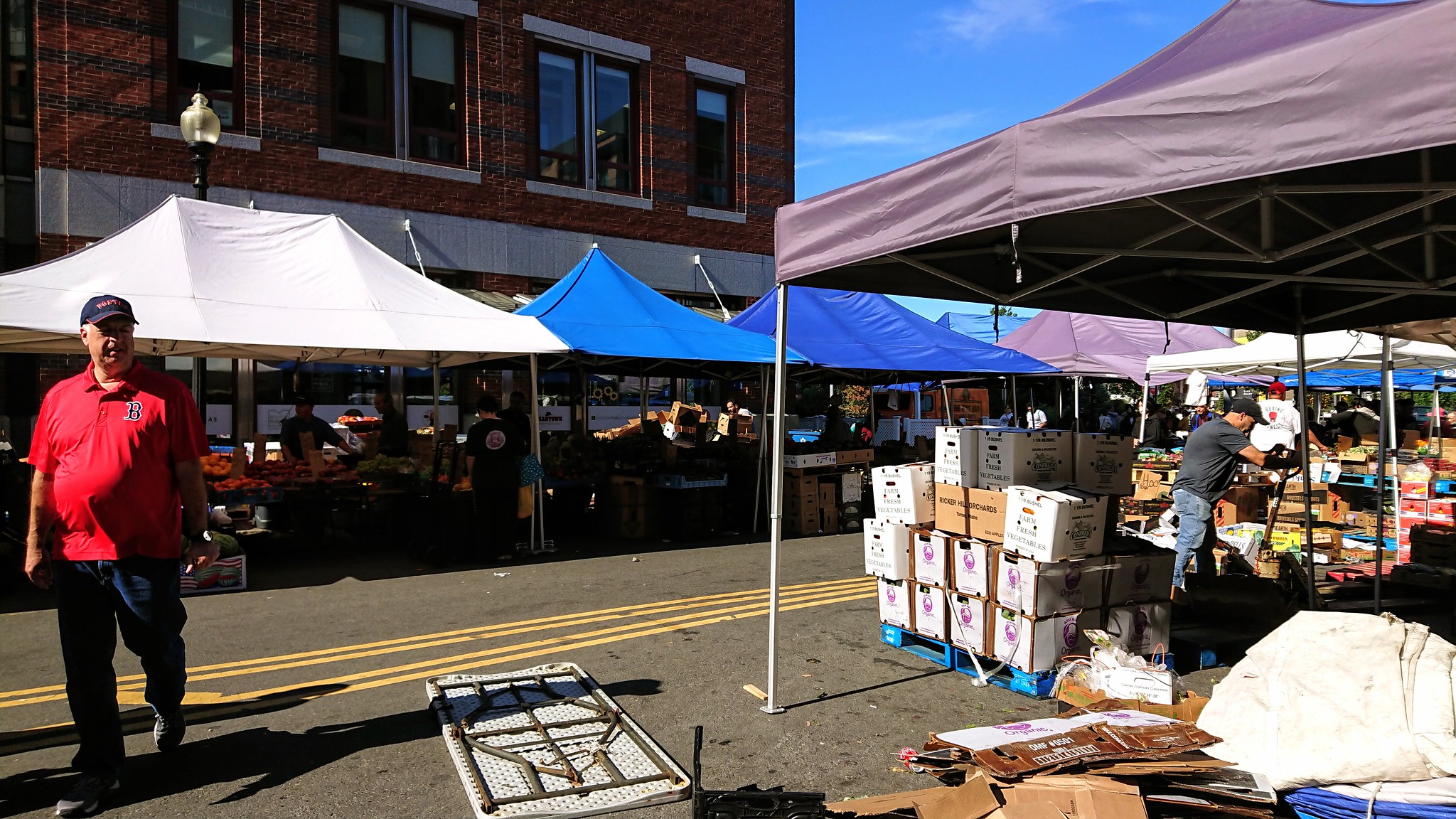
Then we reached the market. The street was lined with vendors selling fruit and other goods. We arrived back in the Italian District on the fountain-lined Rose Kennedy Greenway!
Our next stop is Paul Revere's house, which we also saw the day before, so we skipped it this time. We didn't take a detour. Instead, this time we went to St. Leonard's Church, whose garden we photographed yesterday. It is a Roman Catholic church, one of the oldest built by Italian immigrants in the United States.
It's a lovely church, and you should definitely see the inside!

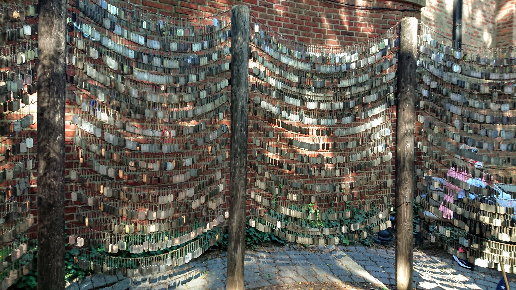
The garden of the Old North Church was still open this time, so we could walk through there.
This garden also has something to see, so it is worth stopping for a moment. There is an Iraq-Afghanistan memorial here. Many dog tags are hanging: in honor of all the soldiers who died in the Iraq and Afghanistan wars (so many senseless deaths because of stupid wars!).
By the way, the Old North Church is the next stop on the trail to get a ticket. Since it was close to 5 PM, we didn't go in since the church closes at 5 PM.

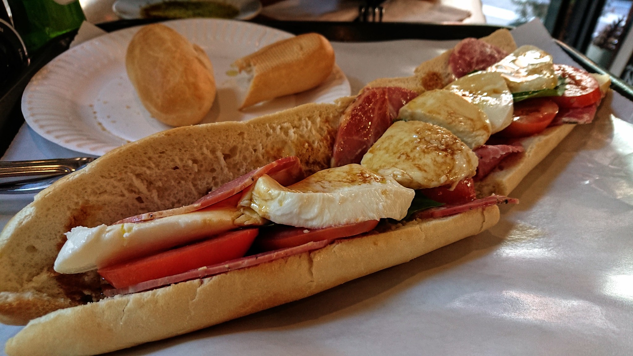
After that, we got hungry (it was already 4:30 PM at this point). Anyway, we did it again on this trip, so one of those late lunches/early dinners after breakfast was enough. So we actually ate twice every day. This time we took a short detour and left the route for an Italian restaurant called Dino's Café. It's more of a small buffet-type restaurant. You have to order at the counter. Csibi wanted a (huge) sandwich, and I had gnocchi. Both were delicious, and we had a good time.
After lunch, we returned to the red line and walked to the next stop, Copp's Hill Cemetery, named for shoemaker William Copp. This is the final resting place of the merchants and craftsmen who lived in the North End. It dates back to 1659 and was once the largest colonial cemetery in Boston. Unfortunately, we couldn't go here either because it's only open until 4 PM.
Across the street from the cemetery is the Skinny House, which is not part of the walking trail but is definitely an exciting attraction and worth a visit. It is the skinniest house in Boston.
Unfortunately, we don't know what it looks like from the inside, but it's a pretty little house from the outside.

From here, the path forks, and there are only two stops. But for that, you have to cross the bridge.
You can walk, but unfortunately, the footbridge is now closed, so you have to walk on the other side of the bridge on a makeshift bridge.
From here, you can see Leonard P. Zakim Bunker Hill Memorial Bridge, completed in 2003 and now a city landmark and frequently in the news. It really looks great!
But there are several bridges here, which are suitable for traffic, although there was still a massive traffic jam as we passed.

When you cross the pedestrian bridge, Paul Revere Park and Playground are on the left. From the park, you have a great view of the city and the bridge mentioned above.
We took a tour of the park and then continued on our way.
Officially, you should go to the USS Constitution first, but we went in reverse order.
Across the street is City Square Park, where there are several monuments.
We went through typical small suburban streets to the Battle of Bunker Hill Memorial.
At this point, we could have really used a restroom, so we first went to the museum across the street from the memorial to use the restroom. We honestly didn't have the energy for the museum, so we skipped it.
We went to the memorial, a 67-meter granite obelisk with 294 steps and probably a spectacular panorama. Unfortunately, we didn't see it for ourselves because it closes at 5pm, so we didn't have a chance to go up.

We rested on a bench for a while before continuing our journey.
This is where the Freedom Trail officially ends.
The Battle of Bunker Hill on June 17, 1775, was the first major battle of the American Revolutionary Wars between British troops and the 13 colonies and gave a taste of the nature and outcome of the war. The battle was technically won by the British, but it turned out that the colonial troops could fight them effectively.
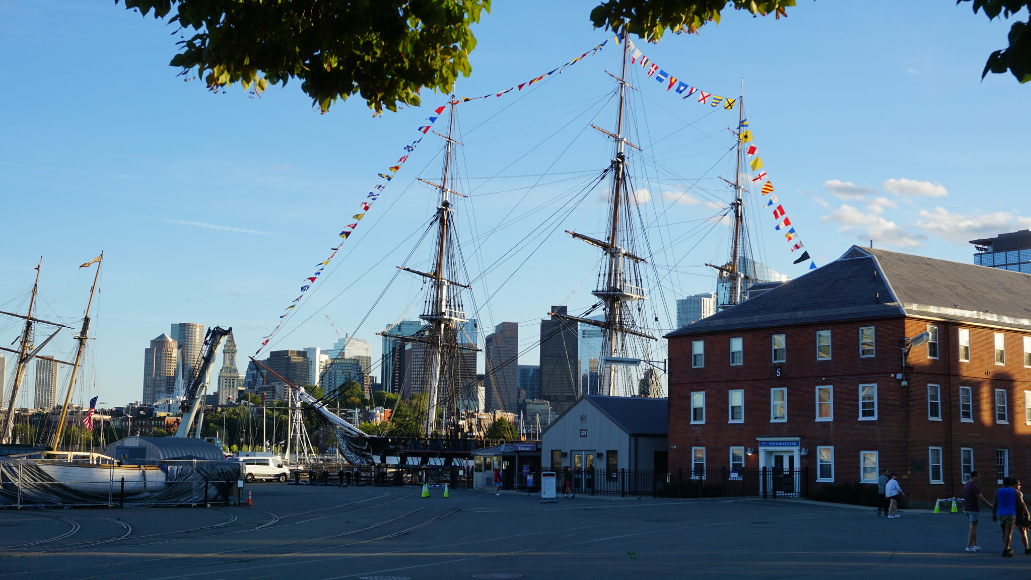
And then, in reverse order or not, we were finally on our way to the last stop. That was on the water, at pier one of the Charlestown Navy Yard.
And that is the USS Constitution, also known as Old Ironsides, a three-masted battleship of the United States Navy. It was launched in 1797. It is the oldest ship of its kind still sailing in the world.
It's now a museum, but since we were late everywhere, we obviously couldn't go here either.
Across the street is the museum of the same name.
The destroyer USS Cassin Young is also located here. Named after Captain Cassin Young, who was decorated for his heroism in the Japanese attack on Pearl Harbor. The ship was commissioned in 1943 and actively participated in various missions during World War II. Today, and it is open to the public as a museum ship.

Of course, this one was also closed.
At this point, every step was very painful because we were very tired that day and the previous two.
We were wondering how we were going to get home at all. It also seemed a challenge to get back to the bus stop.
We couldn't find it at first, and when we finally discovered it, we found that the bus was about 10 minutes late, so we had to wait at least 20 minutes. This is bus 93, which we took to the final stop downtown. Fortunately, the bus at least arrived almost empty, a miracle that the driver stopped at all.
He was driving pretty fast; sometimes, I didn't understand how he could go so fast.
After we got off, we crawled (that was really the best word for what we were doing at that point) to the bus stop of silver line 5, which apparently passed right in front of us. The driver of bus 93 stepped on the gas, but he couldn't make up for the 10-minute delay. If he had been on time, we could have caught him.
So it was the next bus, number five, but we finally made it home.
We covered 6.2 miles (10 km) in 6 hours and 40 minutes that day.
We were very, very tired.
Additional Photos